Fishing is a $200-billion industry in the United States, providing 1.7 million jobs. The economically important Gulf of America Reef Fish Fishery includes more than 890 commercial reef fish permitted vessels and comprises 31 species managed using Annual Catch Limits. Objective, scientific data are necessary to ensure the fishery’s health, but currently, the NOAA Fisheries Observer Program is only able to monitor about 2% of vessels’ fishing effort in the fishery.
To complement this important program and fill monitoring gaps—a need emphasized by federal fisheries managers and the commercial industry—the independent, nonprofit Mote Marine Laboratory operates the Center for Fisheries Electronic Monitoring at Mote (CFEMM).
CFEMM is the only program dedicated to developing and assessing electronic monitoring (EM) technology as a tool in the Gulf commercial reef fish fishery to better meet the demand by industry and management for accurate, independent data to ensure long-term fishery health.
What CFEMM Does: “Eyes on the Gulf”
CFEMM is the lead in advancing electronic monitoring in the Gulf’s commercial reef fish fishery through strategic partnerships with the fishing industry, management organizations, an EM equipment and software provider, and various other stakeholders.
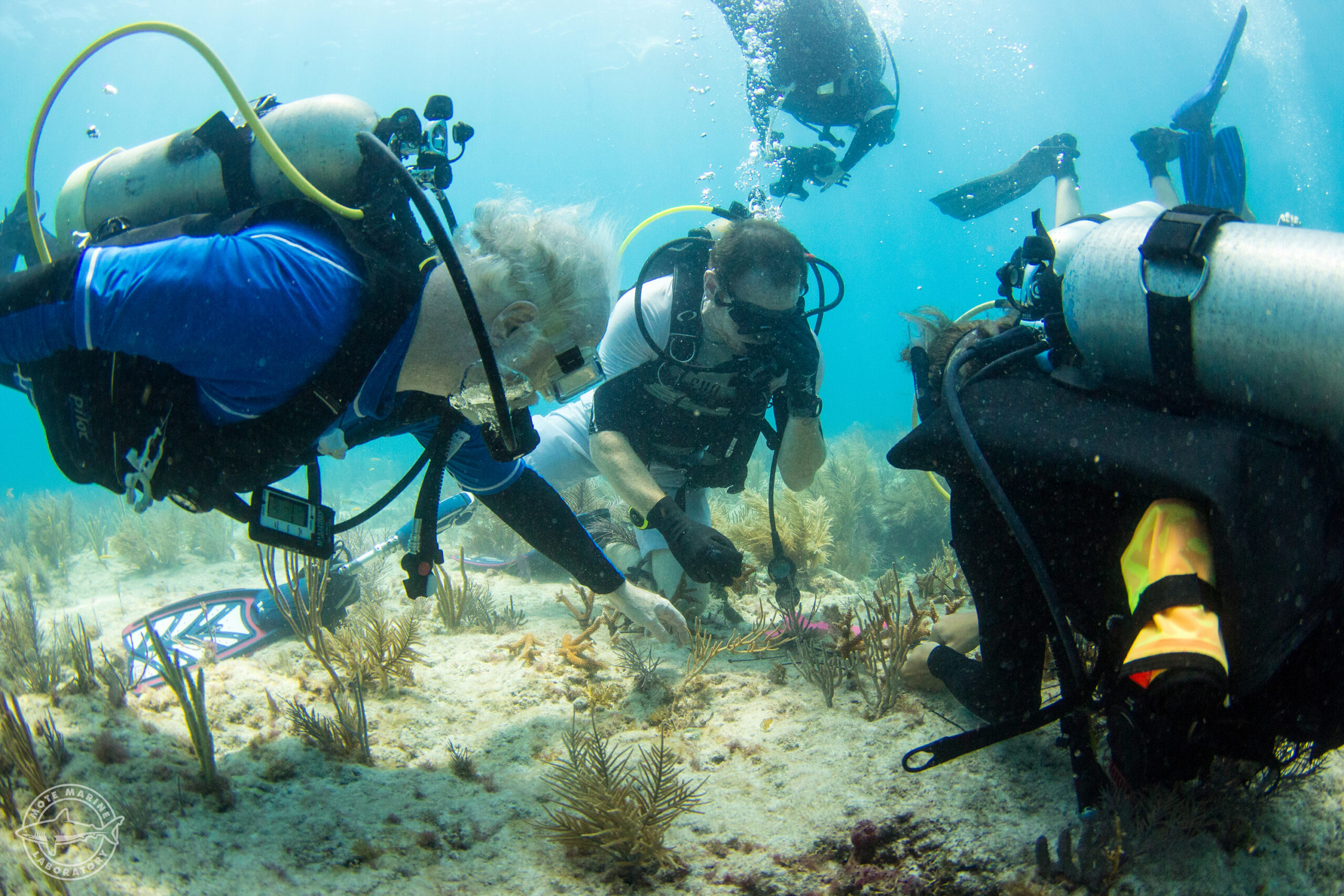
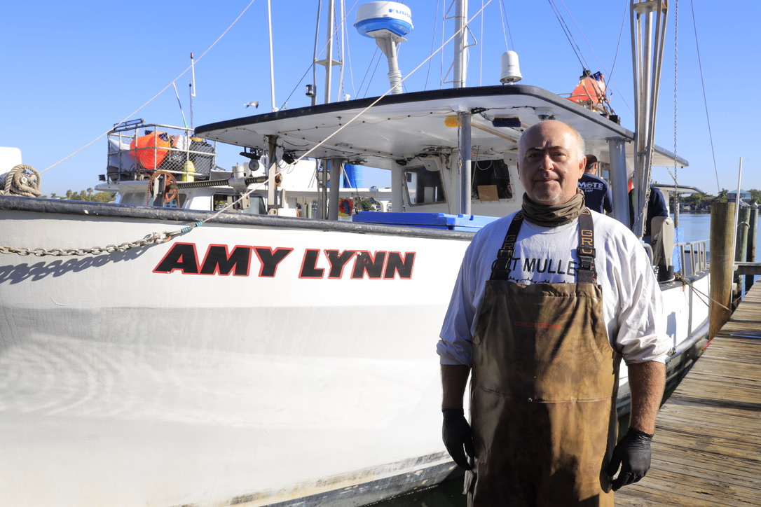
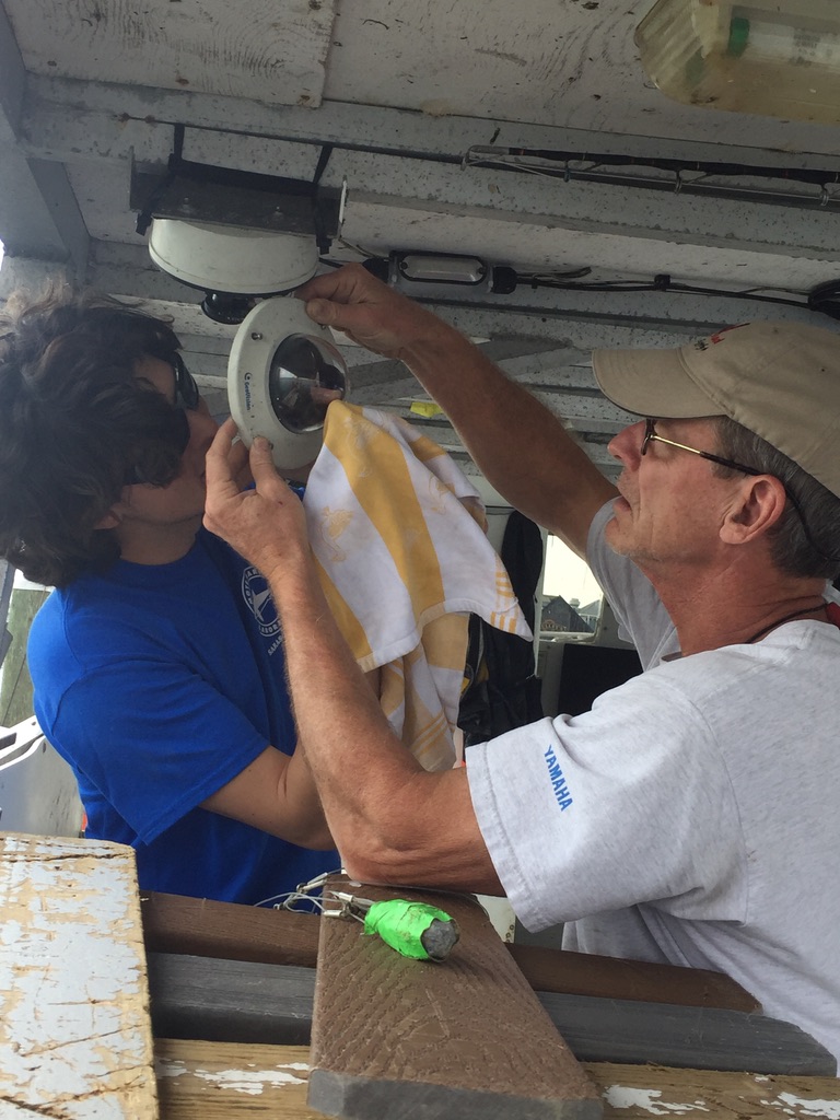
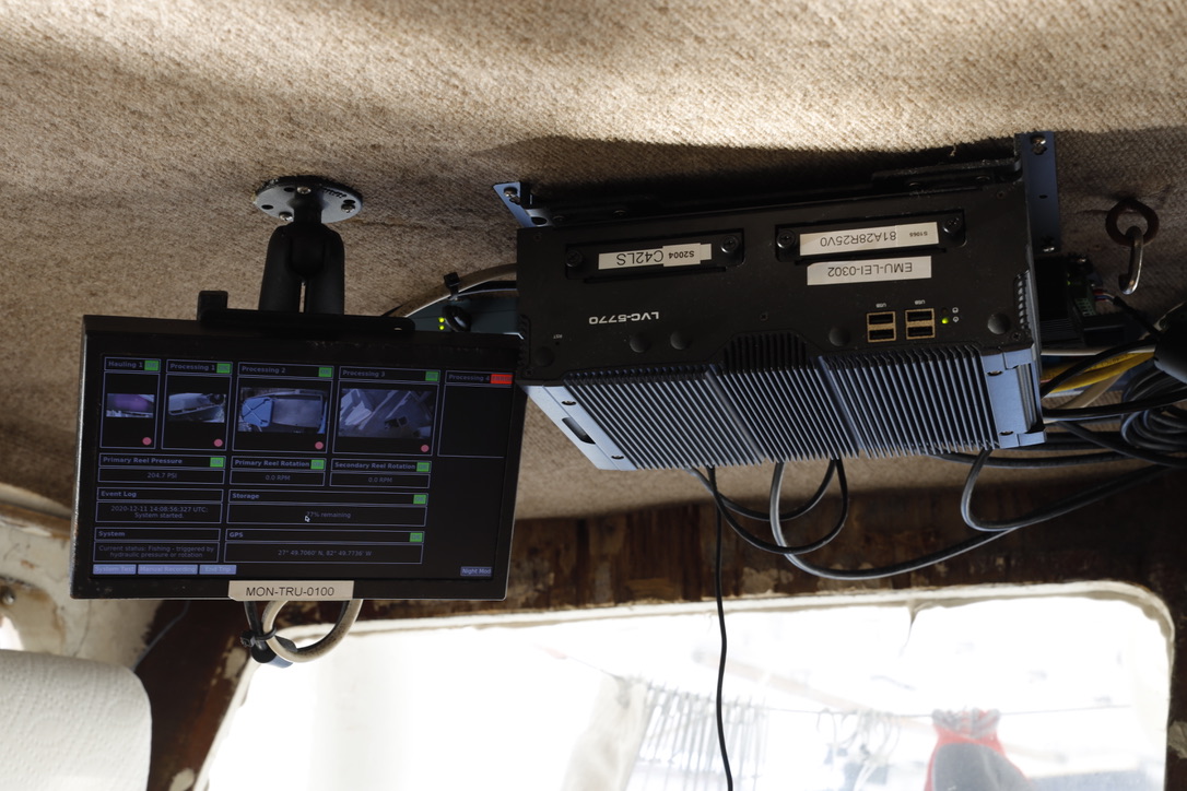
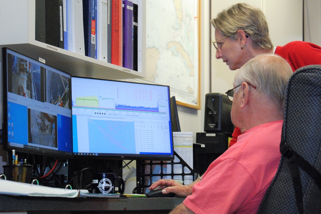
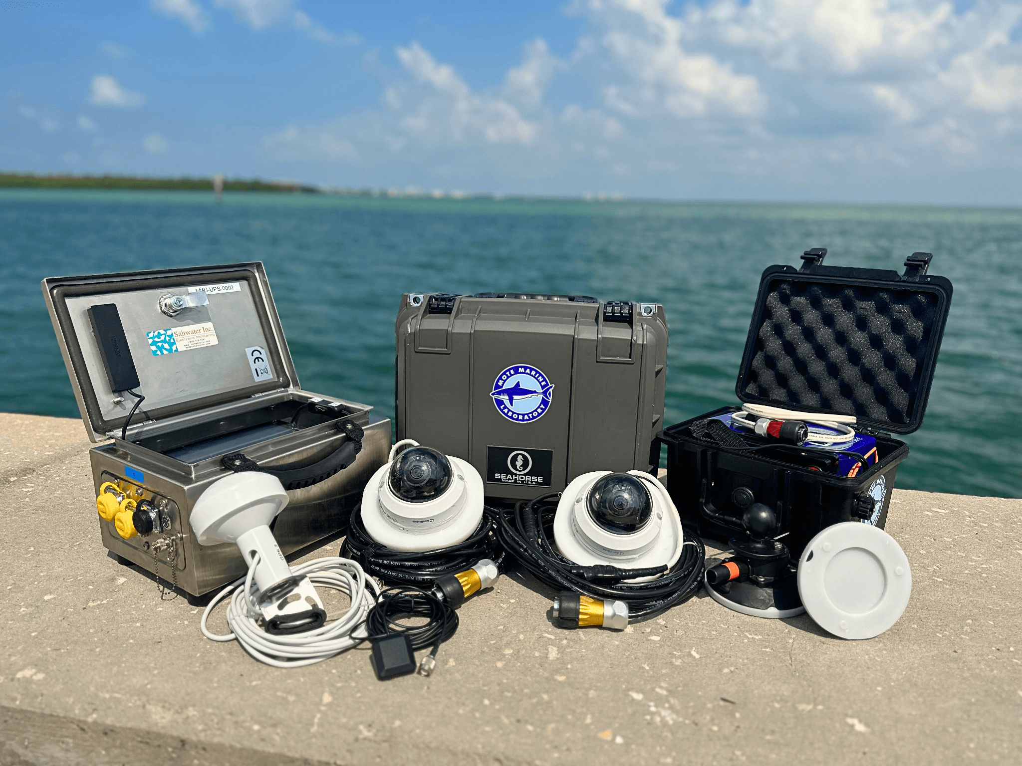
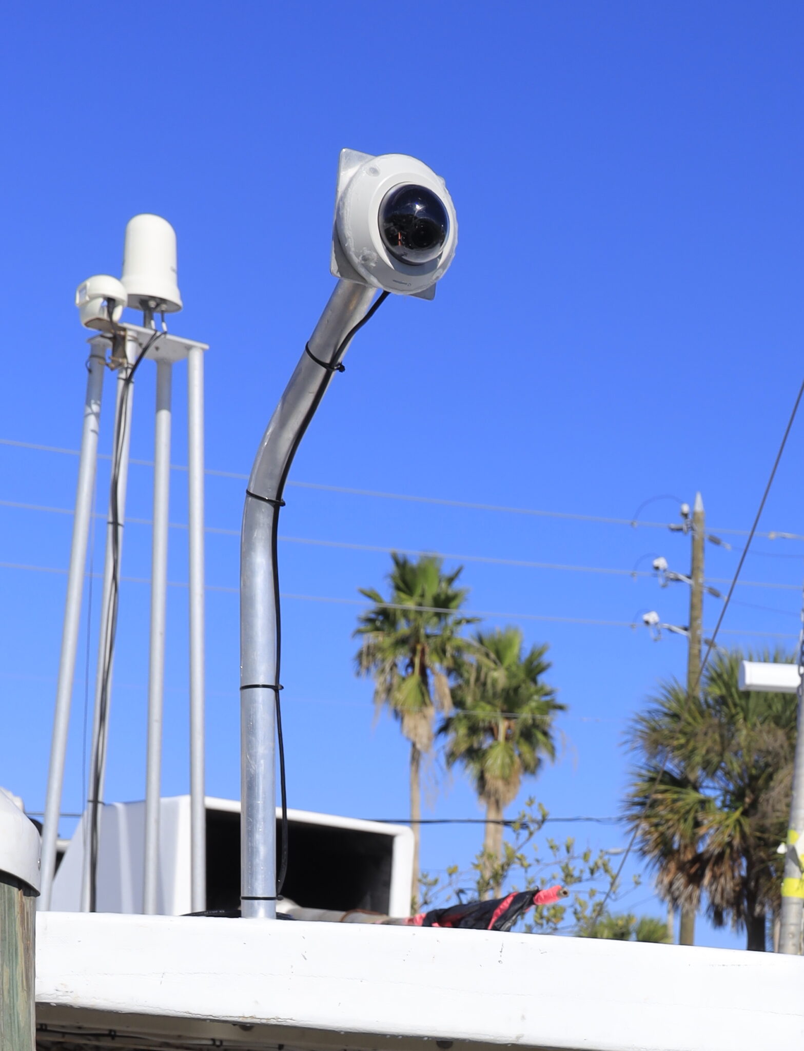
Volunteer commercial bottom longline and vertical line fishing vessel owners and captains partner with CFEMM scientists, EM equipment and software providers to have specialized cameras, a computer processor, and sensors installed on their fishing vessels. These systems record the trip length, speed, hydraulic pressure, location, and fishing events (sets, soaks and hauls) on a timeline. Video recordings (with no sound) are reviewed confidentially by the CFEMM Team to document fishing effort, total catch and bycatch of species per event and trip, species kept/discarded, and species disposition at capture, including depredated (damage by predators) catch, and discards.
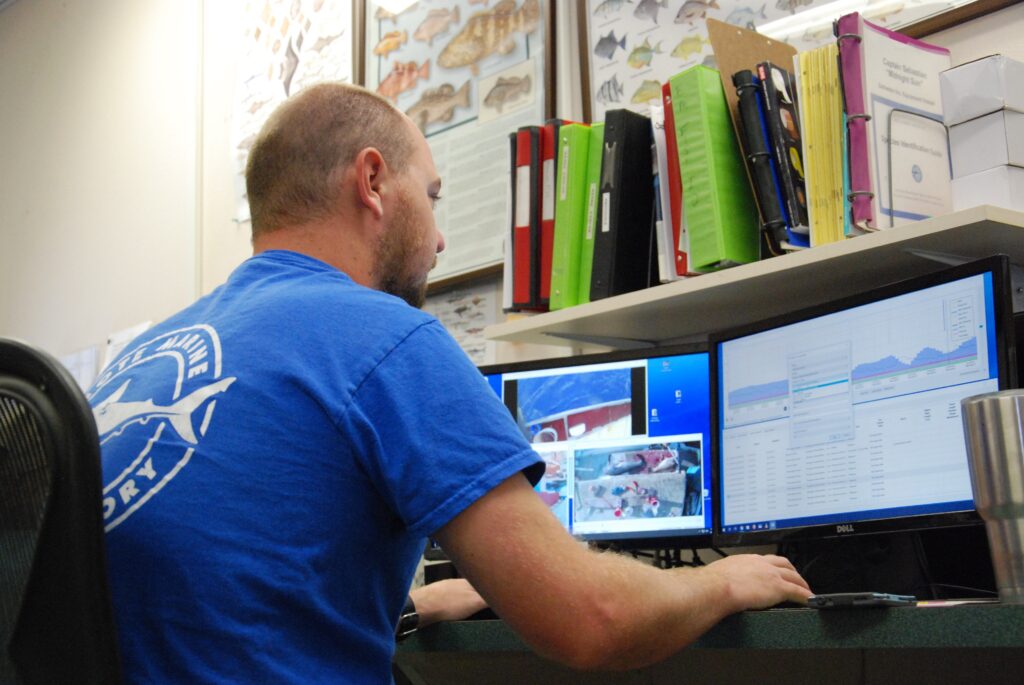
CFEMM scientists analyze the collected data to provide valuable data products—including much-needed bycatch and discard data—that support management of the valuable Gulf of America Reef Fish Fishery.
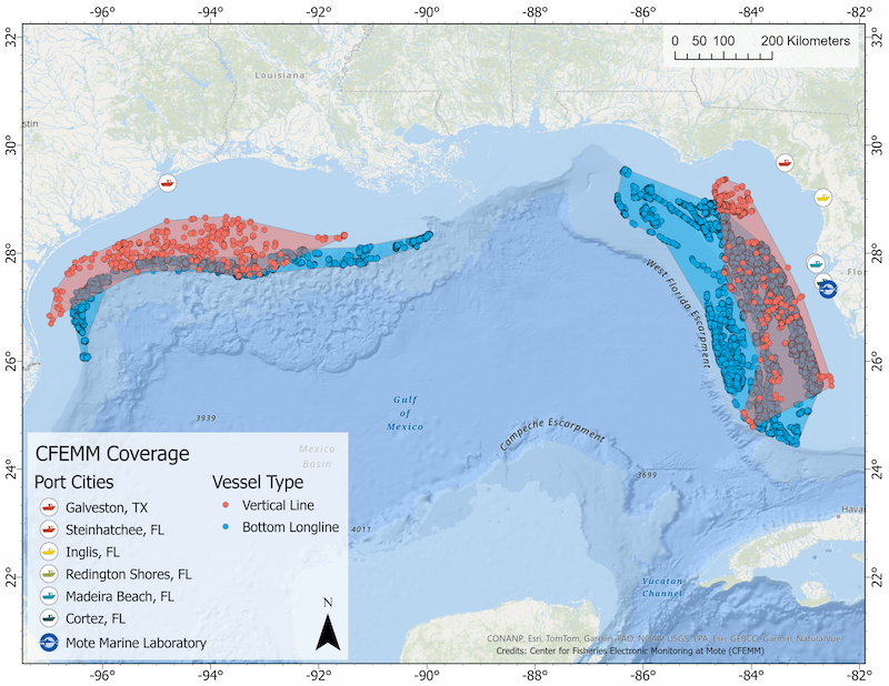
Data Highlights & Vessel Coverage

Data Dissemination
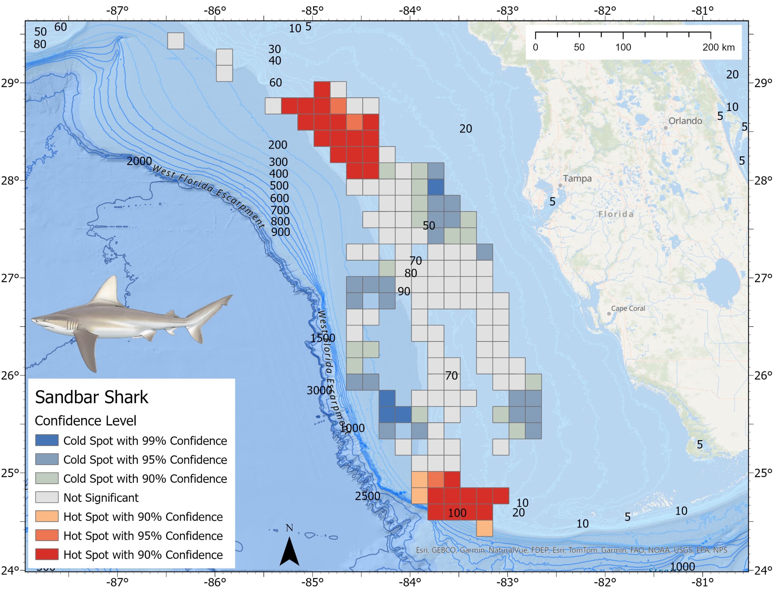
Commercial Fishermen – We prioritize disseminating data back to our vessel participants by offering statistical and spatial analysis products. Some of these include hotspot maps to show where targeted fish are caught, as well as areas where unintended catch (bycatch) and high discards occur. These maps also help identify areas where fish predators (depredators) have been active, aiding fishermen in improving their fishing strategies and sustainable fishing practices. (Click here for an example of a NEW Interactive Tool). Grouped species-specific data products are also provided to fishing industry organizations.
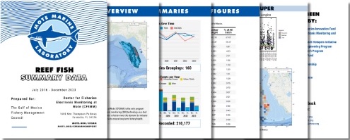
Fisheries Management – We provide grouped species-specific data products for consideration by the SouthEast Data, Assessment, and Review (SEDAR), a collaborative process by which stock assessments are conducted in NOAA Fisheries’s southeast region (See, Working papers). Project updates and data summaries are also provided to the Gulf Fishery Management Council and other federal, state, and independent organization stakeholders (Below: Summary Data booklet).
Advancing EM and filling fishery data gaps through integration of innovative tools
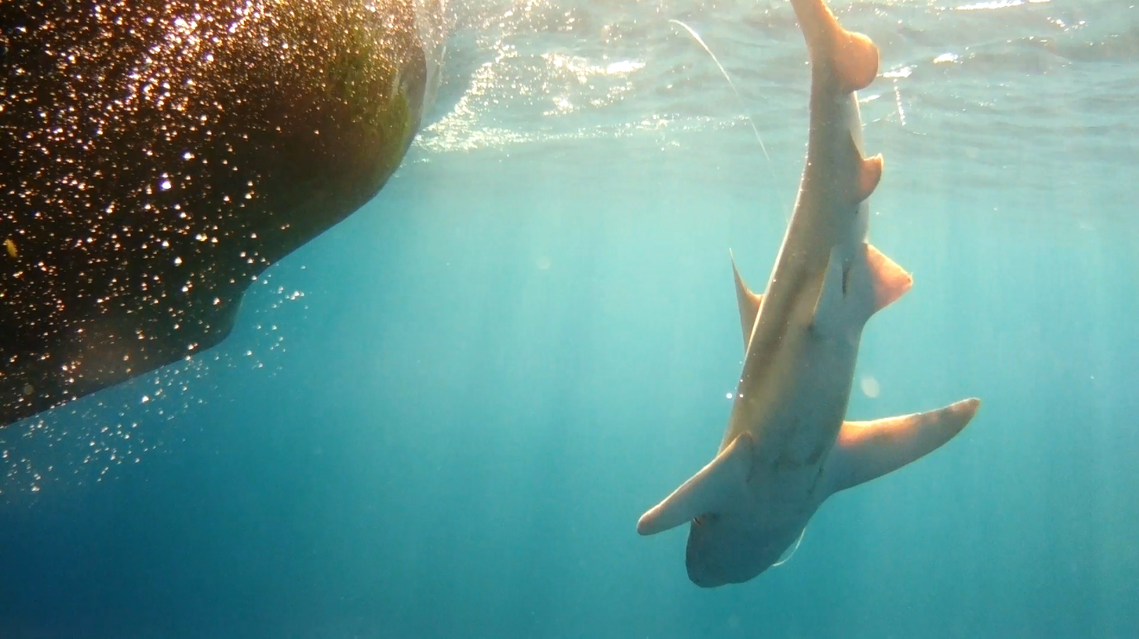
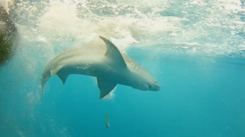
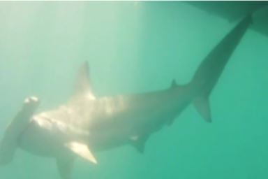
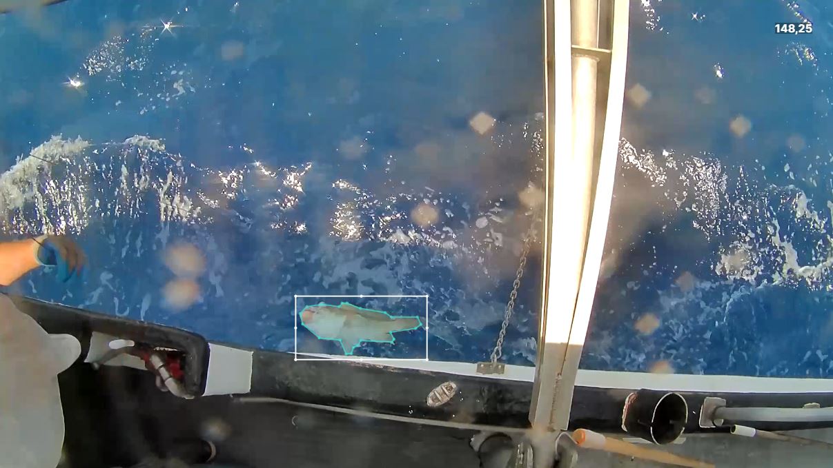
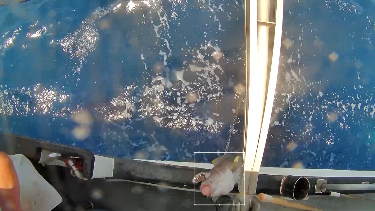
First underwater camera and deployment device to be integrated with an EM system to identify the species of large sharks released while underwater near a vessel. The system also provided valuable footage for documenting shark sex, size range, and short-term post-release fate. (Below Left and Middle: sandbar shark; Right: Great hammerhead shark).
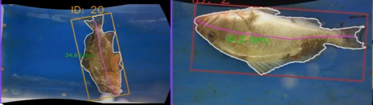
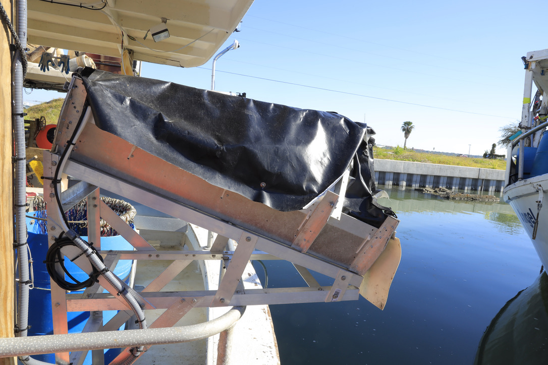
First discard chute installed on a Gulf commercial reef fish fishing vessel in partnership with the NOAA Alaska Fishery Science Center. The chute captured video of undersized red grouper as they passed through; while an automated software algorithm developed by the University of Washington generated individual fish measurements. (Below Left: mounted discard chute; Middle to Right: algorithm obtaining measurements of red grouper discards as they pass through the chute)
First trials of a SWIM-Mobile portable EM system, developed by Saltwater Inc., Anchorage, AK, designed for easy transfer and use across multiple types of vessels. The system was successfully deployed on a Gulf charter-for-hire vessel and two recreational fishing boats to collect data on fish catch and discards.
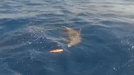
First roof boom-mounted stern cameras installed on bottom longline vessels to document short-term survival of discarded fish behind vessels. This view was used to record whether the fish swam down, floated away, or became prey for predators. (Below Left: roof boom-mounted stern camera; Right: discarded red grouper and bottlenose dolphin interaction)
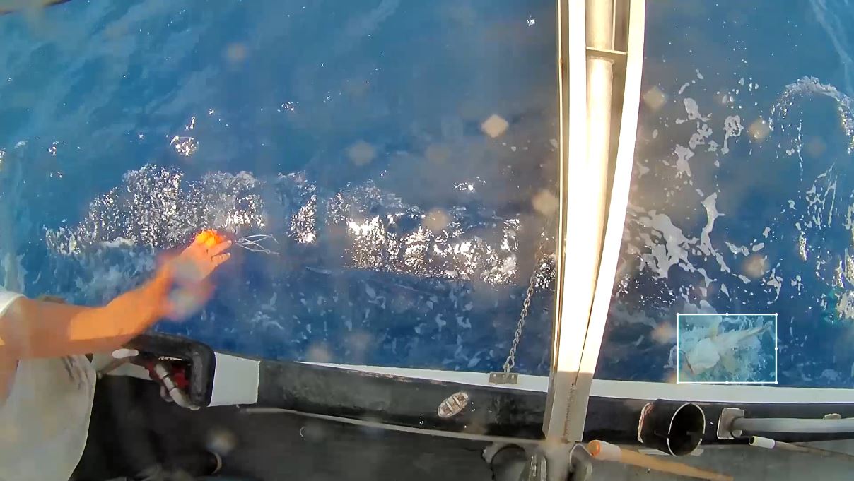
A key innovation in our work is the use of artificial intelligence (AI). Over 40 hours of electronic monitoring footage containing thousands of captured species images were shared with CVision AI, Boston, MA to in develop cutting-edge artificial intelligence (AI) catch detection and classification algorithms. These AI tools are designed to accurately identify catch events, suggest the most likely species caught, and significantly reduce video review time and enhance overall efficiency. (Below: example of an AI algorithm tracking [note the box] a yellowedge grouper as it is hauled onboard a bottom longline vessel)
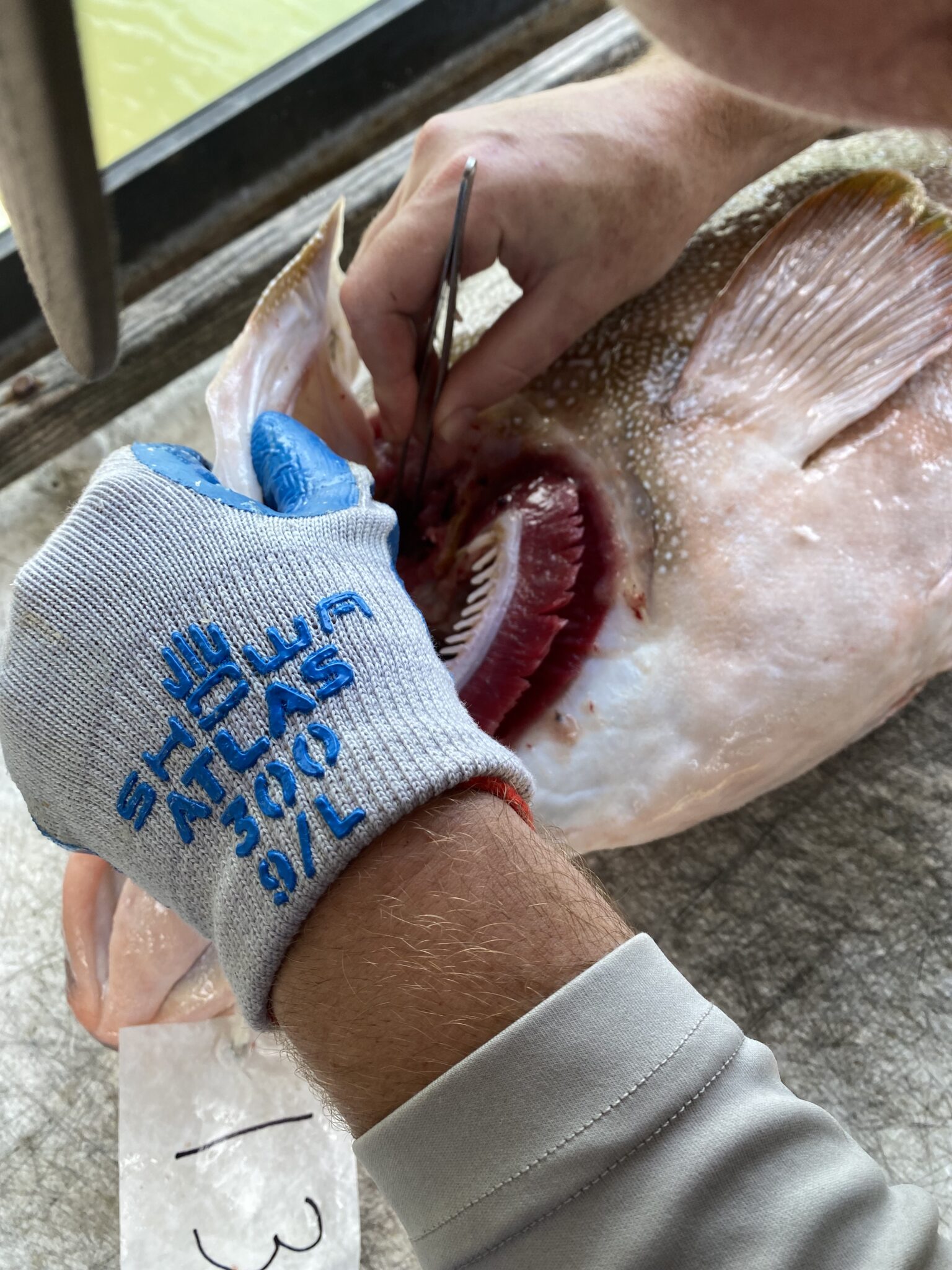
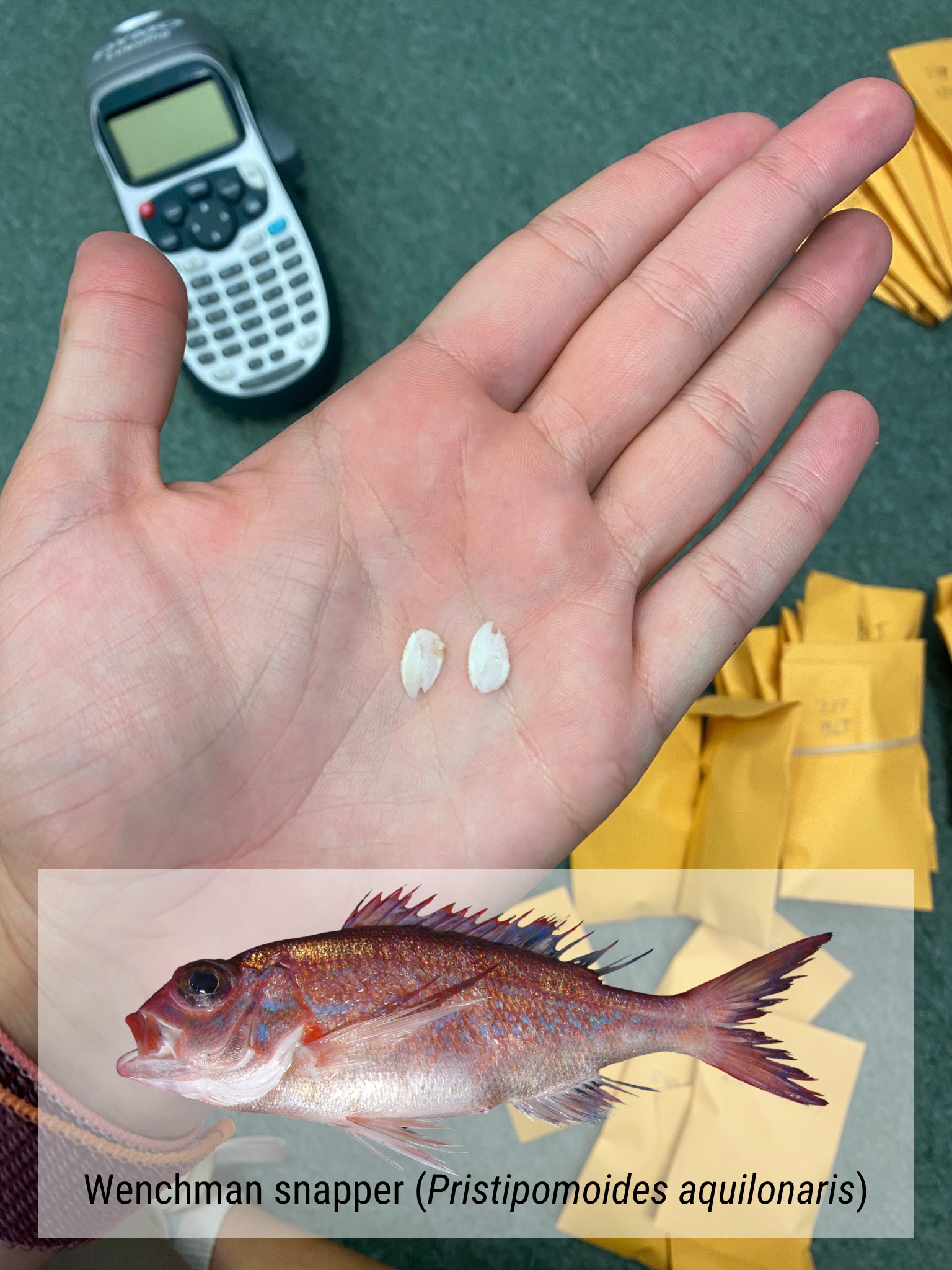
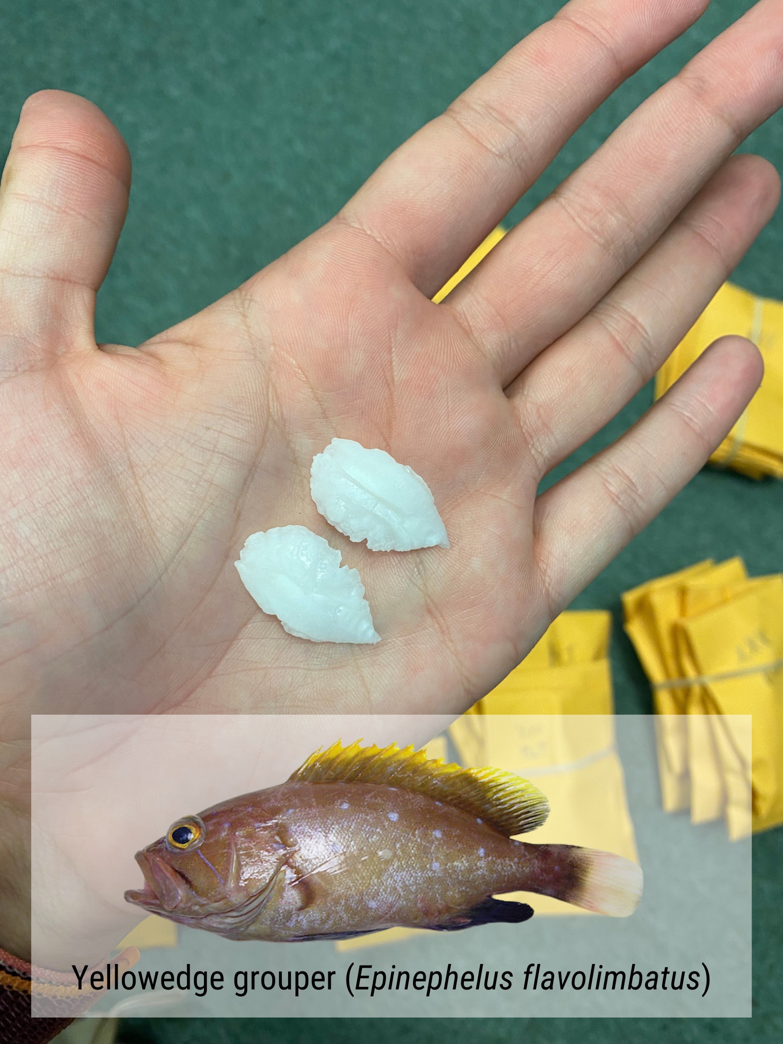
To fill critical data gaps, a partnership with commercial reef fish fishermen resulted in the collection and marking of 262 individual fish from 24 data-poor species. CFEMM staff then obtained length measurements and extracted otoliths ‘ear bones’ and fin clips. The biological samples were provided to NOAA Southeast Fisheries Science Center, Panama City, FL and Texas A&M University, Corpus Christi for age determination and genetic profiling. Importantly, each fish was linked with its respective capture location through EM documentation. Involvement of fishermen’s’ contributions directly supports efforts to better understand these species’ populations and characteristics. (Video and photos: collecting otoliths “ear bones,” from different reef fish species; example of otoliths collected from a wenchman snapper and a yellowedge grouper)
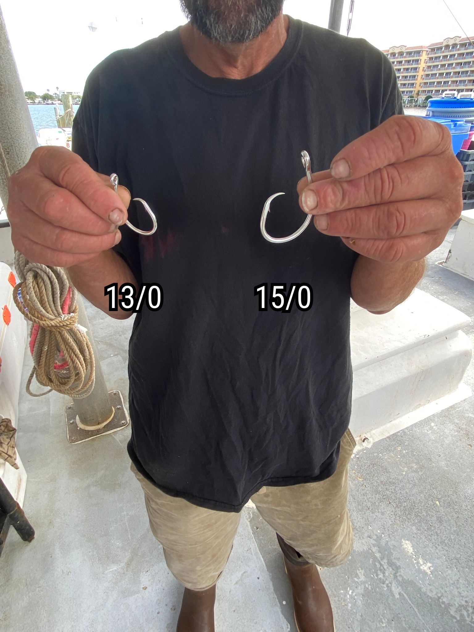
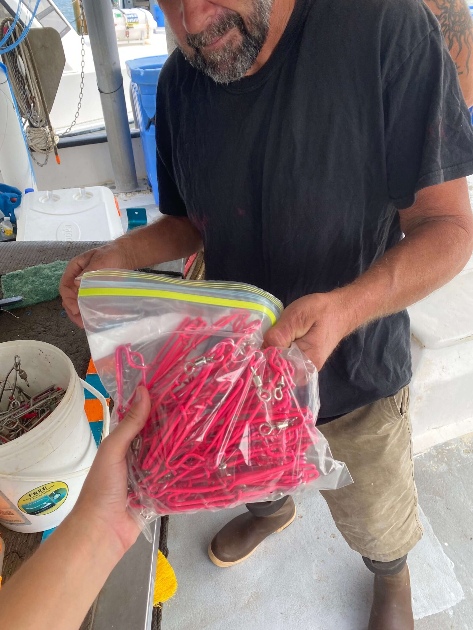
Addressed an industry gear specific question by evaluating the impacts of different hook sizes on fish selectivity, on reducing bycatch and subsequent discards of non-target species.Vessel’s EM video footage provided detailed documentation, enabling scientific evaluation of the species that were caught by the different hook sizes. These detailed analysises shed light on the effectiveness of different gear configurations in mitigating bycatch. (Below Right: painted leader clips to indicate hook size for video review; Left: two evaluated hook sizes,13/0 and 15/0)
 Evaluating “Optimized Retention”, a management strategy approach that focuses on species with high discard mortality, such as red grouper, particularly those that are undersized when caught. This strategy involves NOAA granting fishermen a federally issued Exempted Fishing Permit (EFP), allowing them to retain the smaller-sized fish that are typically discarded.
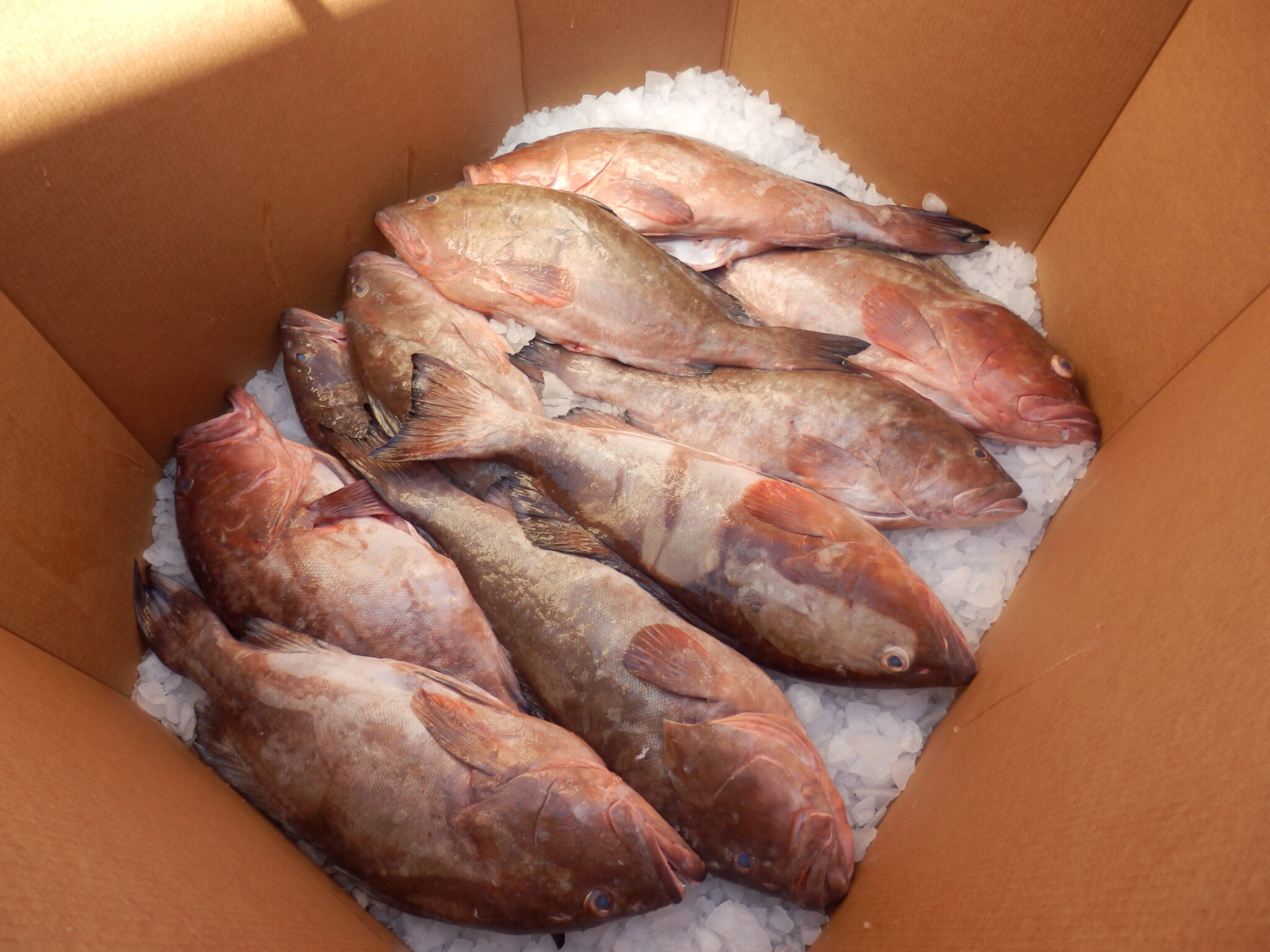
Collaborations with fish house managers will evaluate the market potential of selling fish that were previously discarded. This innovative approach offers benefits for both industry and fisheries management by reducing discard mortality rates and potentially creating new revenue opportunities for industry through the sale of fish that would otherwise go to waste. (Below Photo: undersized red grouper tagged at capture by the fishermen to link individual fish with their EM capture data)
Cutting-edge methods were developed to automate the creation of hotspot fishing maps and personalized trip data summary reports for fishermen. These data products are shared with stakeholders including industry and fishery managers to support more informed and timely decision-making processes. Through streamlined-automation, we are significantly improving the efficiency, accuracy, and accessibility of critical information. (Below: Bycatch Hotspot Map of incidental sandbar shark captures)